

By John Curtin Home Inspector
Content Approved and protected
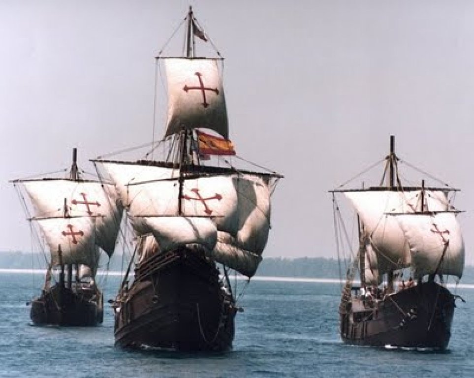
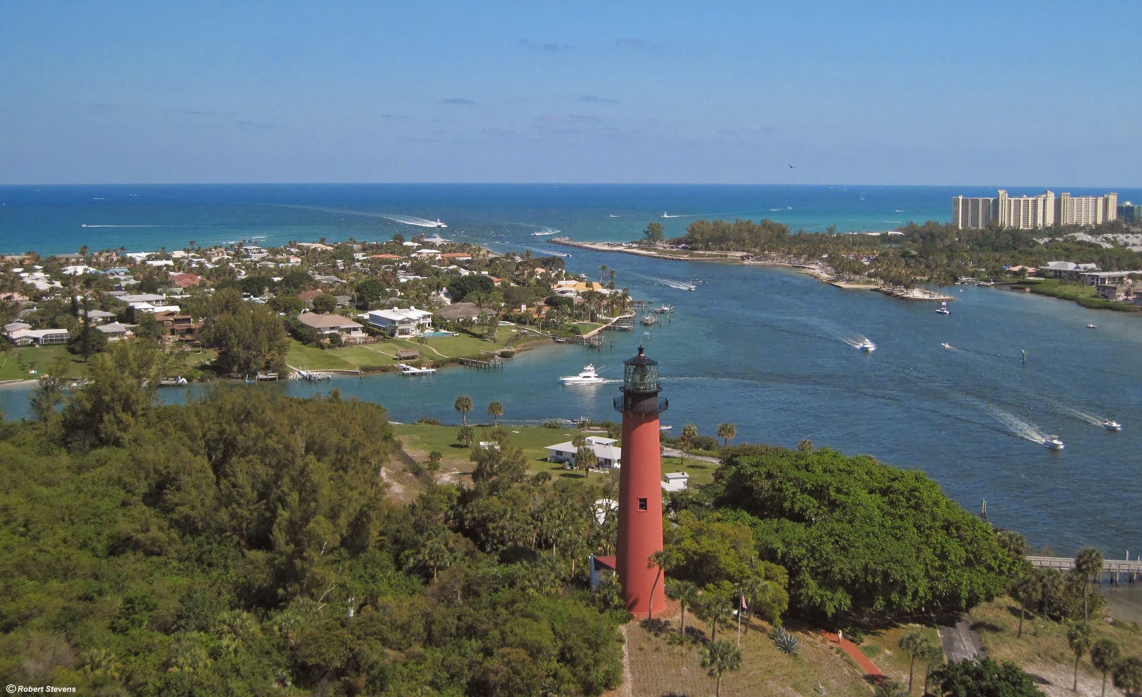
In 1492 when Columbus left Spain heading for China he used the Westerly Trade Winds to bring him across the Atlantic. When these winds encountered North America they turned north and then flowed west back to Europe and are called the Prevailing Westerlies. This pattern of winds is what made travel to and trade with the New World possible. When leaving the Caribbean on their way back to Europe mariners were also aided by the currents of the Gulf Stream. As the Gulf Stream flows past Jupiter, Florida it is at its closest to land, less than 3 miles, and fastest at up to 5 miles per hour.
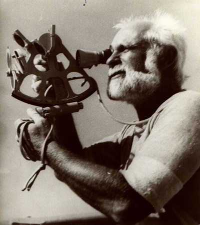
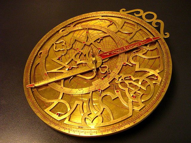 Early mariners relied on their knowledge of the position of the sun during the day and the stars at night along with some rudimentary navigation and calculations to determine their approximate position. From 1000 to the 1400’s mariners used crude tools such as the Astroable and Spar as aids. In the 1400’s the English and other European crowns made improvements to these rudimentary tools and the first navigation charts began to appear. By the time Columbus undertook his journey the compass had appeared and by the 1500’s clocks and hour glasses added the accurate measurement of time to the mariner’s tool chest. These tools continued to be refined and in the 1700s with the development of the Chronometer and Sextant longitude and latitude could be accurately measured. In 1891 radios began to appear on ships enabling the transfer of accurate weather information and by 1910 time and location signals could be broadcast. Modern light houses began to appear in 1915, navigational radio beacons in the 1920’s and the first radars in 1937 along with LORAN beacons shortly after. In the 1960’s the first navigational satellites were launched and in 1985 the first satellite with GPS technology was put into orbit.
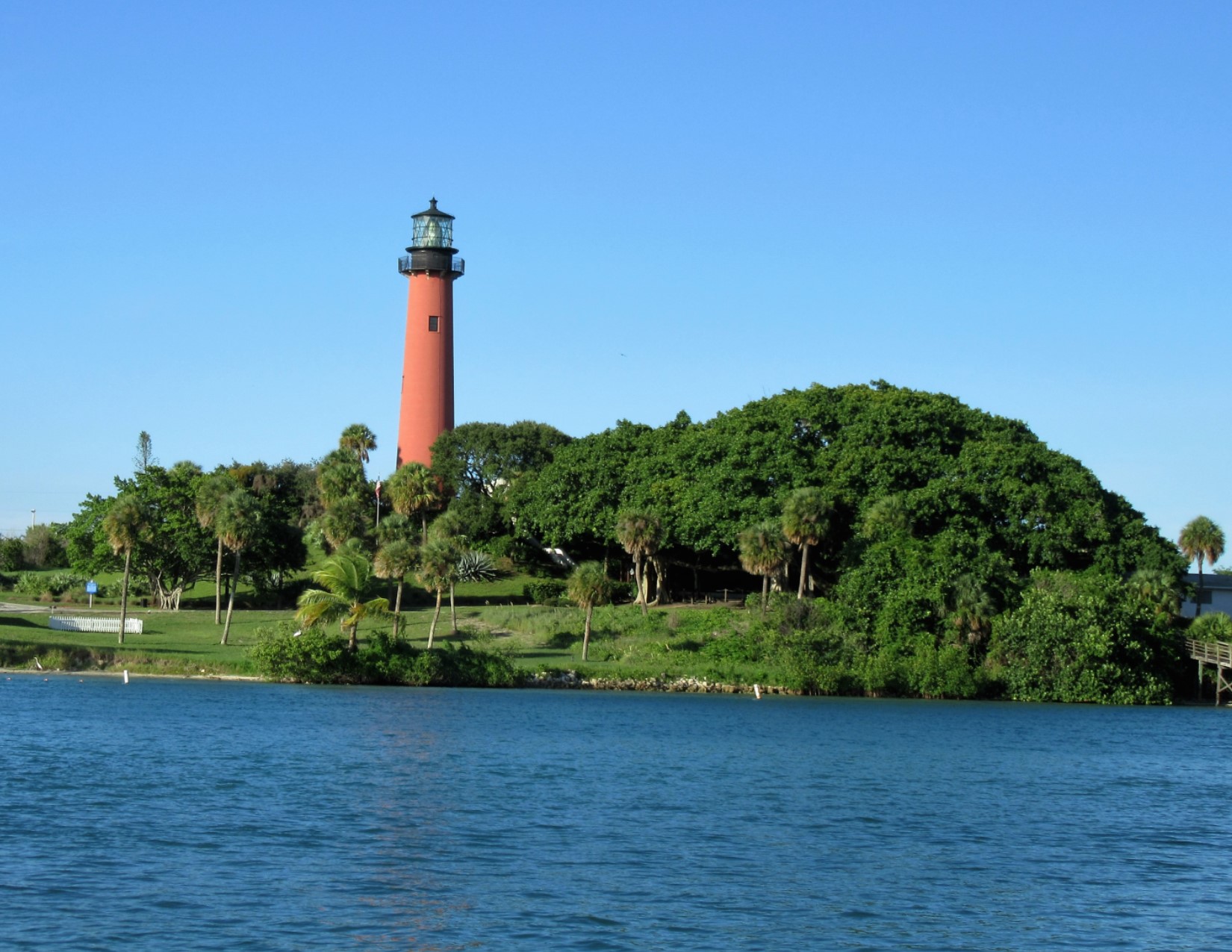
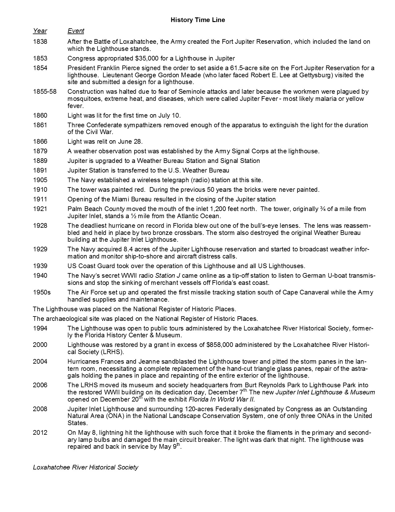
 Until the 1900’s all navigation tools were subject to the weather. If it was cloudy or stormy you were on you own until the weather improved. Additionally, most of these earlier methods of navigation at best represented a rough guess of your position. With the promontory point of Jupiter jutting into the Atlantic and ships passing within 3 miles of its reefs the area was a major hazard to safe navigation. It is estimated that more than a hundred ships have foundered off the shores of what is now Martin and Palm Beach Counties. With a growing United States and its resulting increase in shipping something had to be done so Congress embarked on a campaign of building light houses. By 1952 there were 331 lighthouses and 42 light ships of varying quality and dependability. In 1853 construction began on a light house located at the inlet of the Loxahatchee River. The location for the light house was chosen by Lt. George G. Meade because although it stands quite a bit back from the ocean its natural high prominence aided in the construction and added to the eventual height of the lighthouse. Lt. Meade also designed the tower.
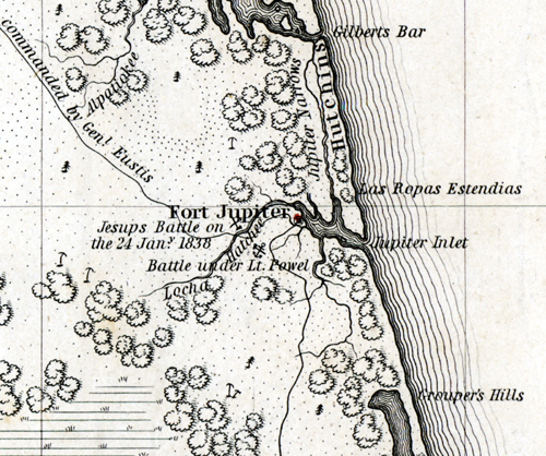 Jupiter as we know it did not exist when construction of the light house began. The Hobe Indians lived in the area around the Loxahatchee River. A mapmaker misunderstood the Spanish spelling "Jobe" of the Indian name "Hobe" and recorded it as "Jove". Subsequent mapmakers further misunderstood this to be the Latin translation of the god Jupiter. Thus the Loxahatchee was known to locals as the Jupiter River. In July 1838 the Fort Jupiter reservation was opened and homesteading and settlement began on the north side of the river.
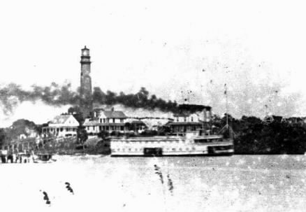
Construction was very difficult due to the remote location, tropical climate, disease carrying insects and hostilities with the local Indians. Additionally, the Jupiter Inlet which was historically located closer to what is today the Jupiter Beach parking lot would only be open intermittently so transportation of materials was difficult.
 Due to shifting sand and ocean currents the inlet closed from 1840 until 1844 and again from 1847 until 1853 when it opened briefly. In 1855 the Army attempted to clear the inlet but their attempts proved futile. Over the ensuing year’s additional attempts were made to make the Jupiter Inlet navigable and dependable so it could support trade but in 1880 the Army gave up and permanently closed Fort Jupiter. Between 1913 and 1922 the Inlet meandered north approximately 1200 feet to its current location. Ocean currents would close it with sand and it would remain closed until the waters of the Loxahatchee, aided by heavy rains, would begin to trickle then grow to a rushing torrent and reopen the channel. In 1936 the channel was dredged for the first time and in 1941 a more extensive dredging was completed. Yet in the 1942 due to the war it was allowed to silt over and it would not be reopened until 1947. In 1966 a sand trap was dug at the junction of the river and the northern branch of the Intracoastal channel and this 20-foot hole is dredged annually to keep the Jupiter Inlet permanently open.
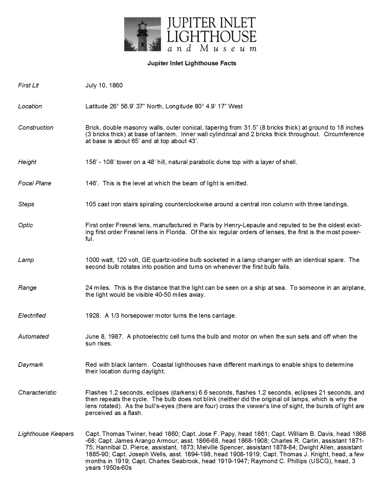
 When construction started in 1853, with the inlet closed, workers were forced to move 500 tons of construction materials down the Indian River using shallow boats which contributed greatly to cost overruns. Originally budgeted at $35,000 the lighthouse was finally built and opened at a total cost of nearly $61,000. The 108-foot tower was constructed on a 48’ dune covered with a layer of oyster shells for a total height of 156’. It's brick walls taper from 31 inches thick at the base to 18 inches near the top. There are 105 cast iron steps with 3 landings. The lantern has glass fitted with astragal which surrounds a First Order Fresnel lens. It produces a “flashing” white beacon with a lens focal plane at 146 feet above sea level and a visibility range of 25 miles to ships at sea. If you were in an airplane the light would be visible up to 50 miles. Each lighthouse flashing beacon is as individual as a person’s fingerprint. The Jupiter Light flashes for 1.2 seconds, eclipses for 6.6 seconds, flashes for 1.2 seconds and eclipses for 21 seconds before beginning its cycle again. The light was finally lit on July 10 in 1860. The light house is located at a Latitude of 26° 56’9’ 37” North, Longitude 80° 4.9’ 17” west.
 In 1861 during the Civil War the lighthouse went dark when Confederate sympathizers removed its Fresnel lens. It also suffered damage from a hurricane in 1865 so the light was not relit until July 1866 after the damage was repaired and the lens was recovered and reinstalled.
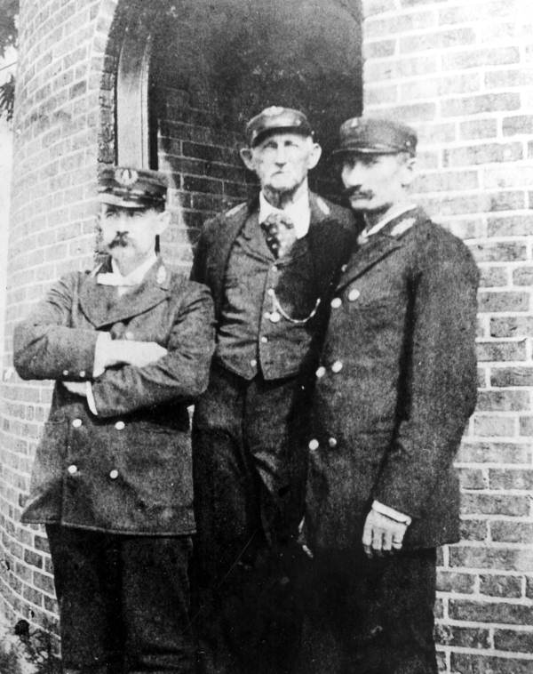 In 1886 the United States Life Saving Station in Jupiter was established with Charles Carlin as its captain. Its purpose was to aid in the rescue of mariners whose ships foundered on the shoals in the area. In 1886 the lighthouses’ source of illumination was upgraded from oil lard to kerosene and in 1910 it was painted red to protect it from damage due to the wind and salt air. In 1928 the lighthouse was converted to electricity but shortly after during the devastating "Hurricane of 1928", the lighthouse keeper had to quickly convert it back to oil and manually turn the light mechanism. It was said that the lighthouse swayed back and forth 17 inches during this intense storm, and one of the Fresnel lenses blew out.
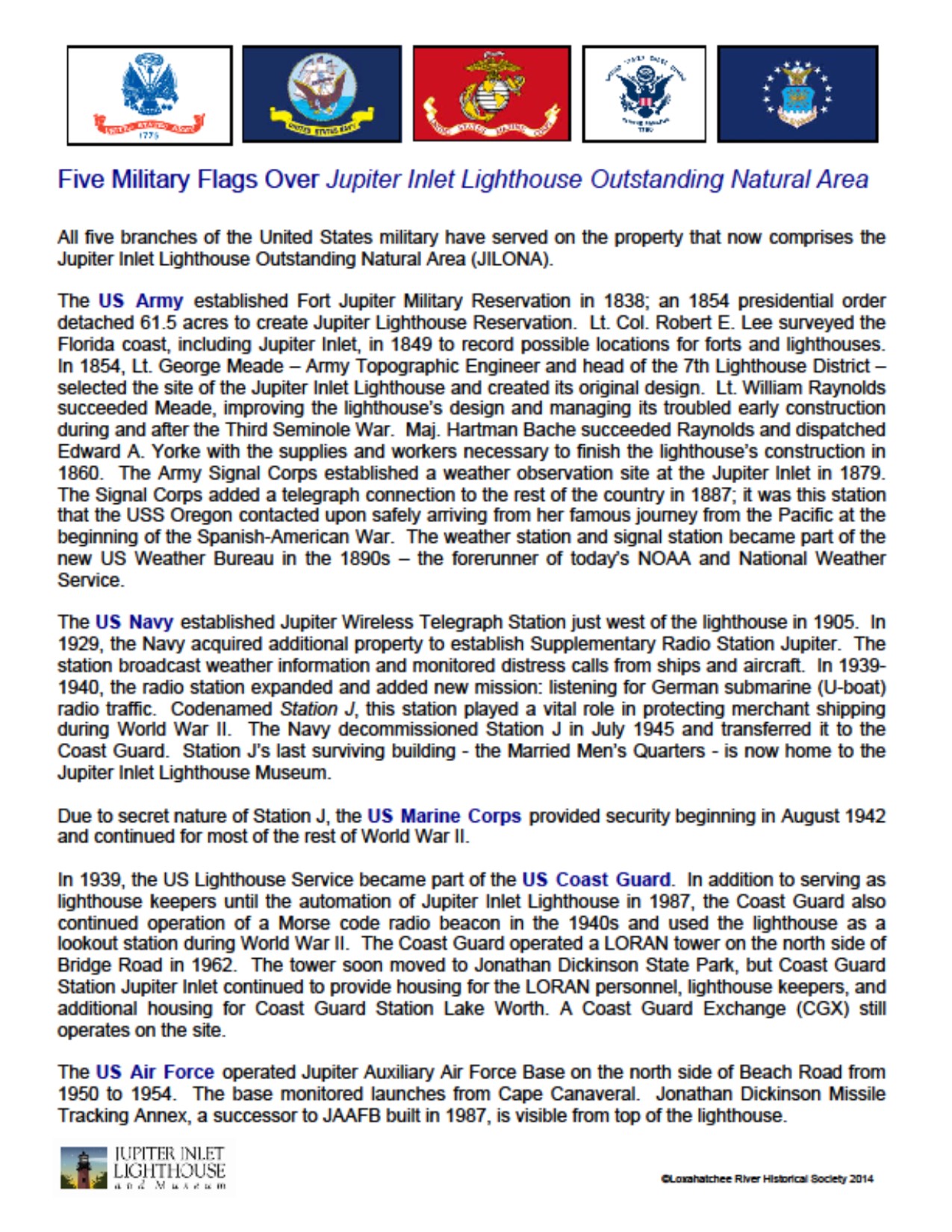
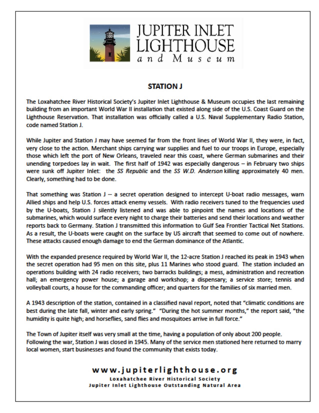
In the late 30’s as World War II was developing the light house property was taken over by the US Coast Guard and later a secret radio listening station was installed to monitor German U-boat traffic. Information could be relayed to passing ships to aid in protecting them from the lurking submarines. Still U-boats were known to sink some 111 Allied ships off the coast of Florida with a death toll of nearly 900 souls.
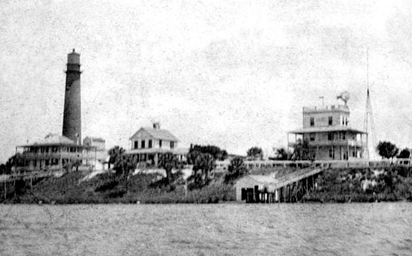
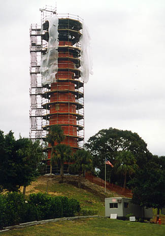 Over time a number of buildings came and went to support the lighthouse, it’s keepers and their families and in 1975 the lighthouse was added to the National Historic Register and in 1987 it was automated. In 1994 The Loxahatchee River Historical Society entered into an agreement with the U.S. Coast Guard to maintain the Jupiter Lighthouse and to provide tours to the public. In 1999 contractors worked for almost seven months to restore the lighthouse back to its 1860s standards thanks to a grant of $850,000 from the Florida Department of Transportation to the Town of Jupiter. In 2006 The Jupiter Inlet Lighthouse and Museum opened.
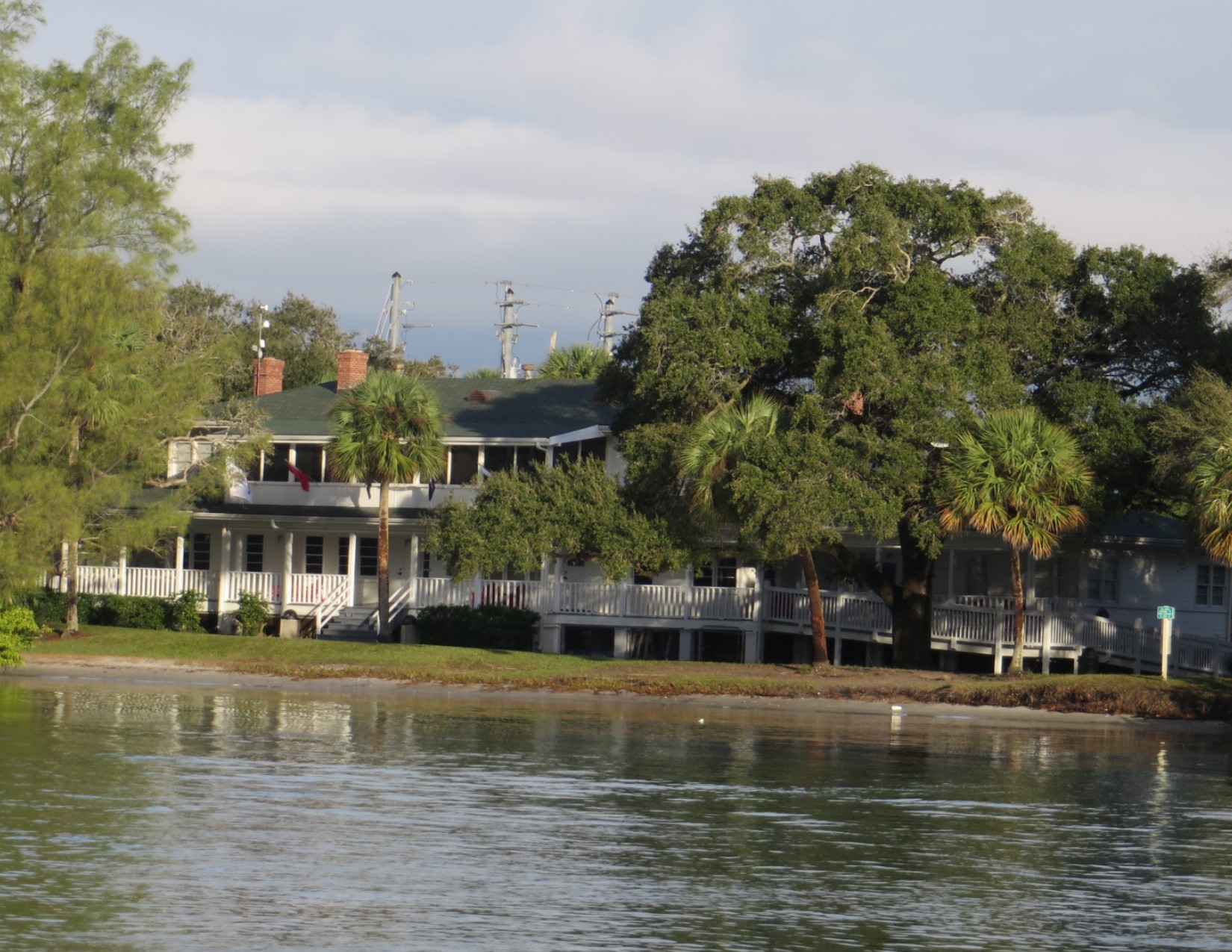
The large building across from the parking area was originally built in 1938 as a married men’s quarters for the Coast Guard. It now houses the Lighthouse Museum, Gift Shop and administration offices. Built to track German U-boat activity “Station J” as it was known was closed in 1945 and by 1958 most of the military related structures were demolished. Since 1994, with only a few interruptions, some “Friends of Bill” have meet on The Porch of this building every morning at 7AM come rain, shine or "snow".
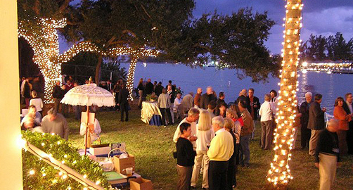 The Jupiter Inlet lighthouse and museum is open for tours daily from January through April and is closed Monday during the summer months. Weddings and other events are held on the light house grounds. Visitors are permitted to access the lighthouse and lighthouse grounds only through guided tours. Tickets are available at the gift shop and are $10 for adults, $5 dollars for children up to 18 years of age and free for children 5 years and under. You must be at least 4 feet tall to ascend the lighthouse. For more information, contact the Lighthouse Museum at 561-747-8380 or go to http://www.jupiterlighthouse.org/.
Credit and thanks to the Loxahatchee River Historical Society for the use of archival photos and information documents.
 .
.
 Lighthouse Museum
 Lighthouse Facts
 Lighthouse Timeline
 Lighthouse Flags
 Lighthouse Station J